My rafting trips in the Grand Canyon have become quite popular and this year I added an additional 7-day trip to my regularly scheduled 10-day trip. A shorter trip is preferred by some people and allows those with work responsibilities to see the entire canyon in one week. We travel 280 miles - the whole length of the canyon. Every trip is different, with different boatmen, hikes, stops and camps. My recent trip was one of the best ever! Have a look.
This blog is widely read as a geology site and I normally highlight items of geologic interest. You will certainly find that in here but I also include additional camp scenes for those you are considering a rafting trip with me. The dates for the 2012 trips are: 7-day: June 10- 16; 10-day: September 12 to 21.
This particular posting is photo-rich so I will keep the captions short.
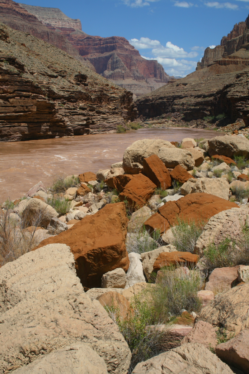
There is high water in the Colorado River this summer and our first hike of the trip was 50 meters downstream from the put-in! I had never hiked to this view of the river from the left bank. The Vermilion Cliffs rise in the background. Note the old Mormon road next to the river - this is where the wagons would approach the ferry site.
Here are wagon ruts from the 1800's carved into the Shinarump Conglomerate on our way uphill.
A giant petrified log was found across the trail. This one was over 100 feet in length and four feet wide.
Kaibab Moon Rise - Our first nights camp was along the Fence fault and I took this shot just as the call for dinner was made. Just 3o miles into the canyon, we were already 1700 feet deep within it.
Our first stop on Day 2 was near Stanton's Cave at South Canyon, where a series of Anasazi ruins and petroglyphs are found.
This section of the canyon it beautiful as it runs directly through the Redwall Limestone. Here solutions have created a series of caverns that formed along fractures (both evident here).
A very few of these solution caverns are still active in the canyon today! This is called Vasey's Paradise.
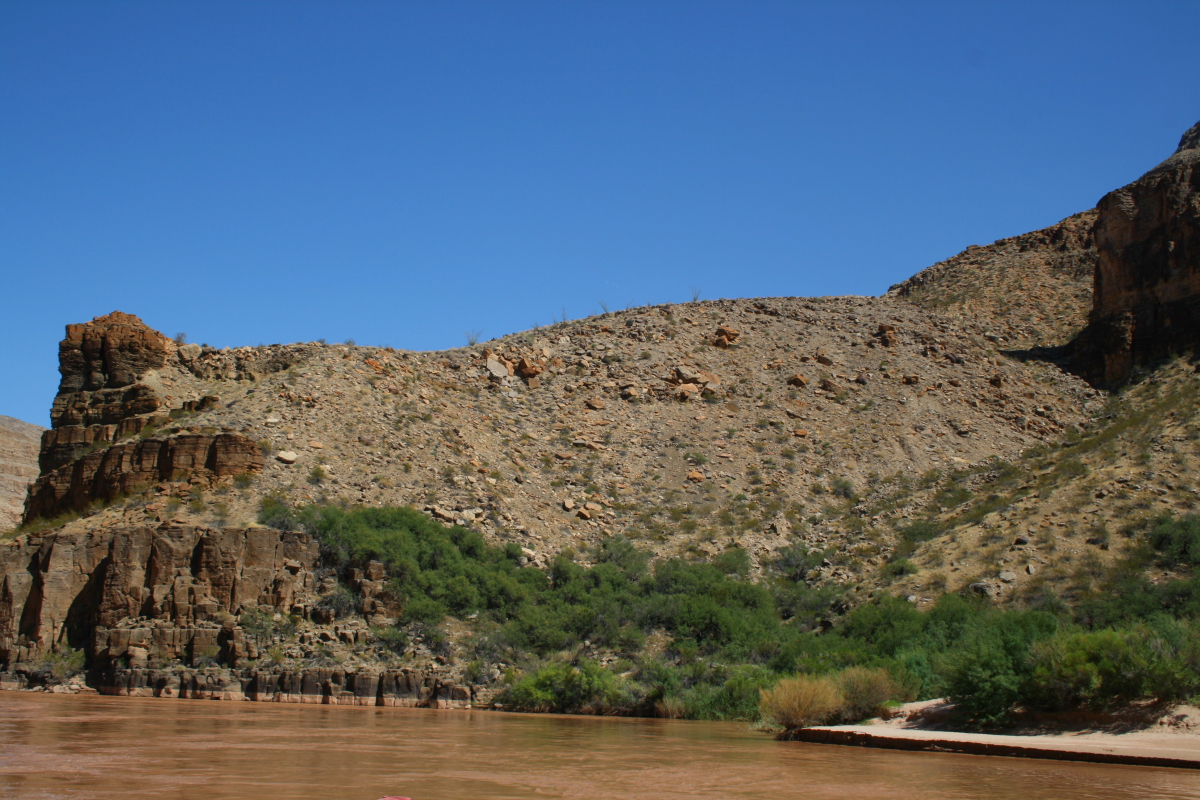
The Grand Canyon is not finished yet and the elements of erosion make for some interesting sights and photographs from the boat.
Spectacular Redwall Cavern at River mile 33. This huge amphitheater was scoured by eddies at extremely high flows before Glen Canyon Dam.
Bill and Ann share a quiet moment inside Redwall Cavern. The clean sand felt good on our feet.
Group photo in Redwall Cavern
This is an 1871 photograph in Marble Canyon taken by one of Powell's men.
We recreated the same photo here. Reliving history is a great part of these trips.
We made a fantastic climb up to a granary site at Nankoweap Canyon.
This is the view downriver from the granaries.
From camp on Day 2 I spied an old alignment of the Colorado River before it shifted course. Note the truncated wall just above the center line in the photo. This surface is capped by Colorado River cobbles and boulders. The approximate age is unknown but may be as old as 300,000 years - it sits about 100 feet above the modern river channel.
The next day we climbed up to the Hilltop ruin. This is located in the widest part of Grand Canyon and may have been a lookout or vision quest site some 1,000 years ago.
Looking upstream from Hilltop ruin on the Colorado River in Grand Canyon.
Scouting Unkar Rapid - from 300 feet high!
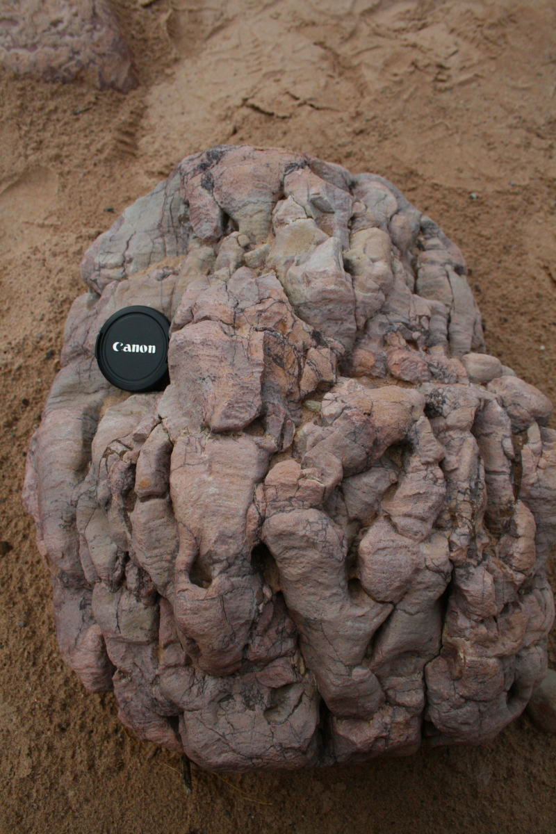
"Bleached" circles can be found everywhere in the Dox Sandstone in this part of the canyon. They are a curiosity and formed when otherwise oxidized rocks (red) become reduced. These are spheres but have the misnomer of
reduction spots.
The upper Granite Gorge is one of the most incredible defiles in all of Grand Canyon. The river has been very efficient at cutting through these resistant rocks.
The New York Yankees have their symbol in pink granite dikes near Crystal Rapids. I do not have a waterproof camera so there are no pictures of whitewater in this blog posting.
Preparing dinner at our 3rd Camp near Shinumo Creek.
The bar-b-q is blazing.....
...Rachael gets the salad ready......
....Carolyn grills the chicken.....
....and Jake and Rachael share a tender moment.
More pink dikes in the Vishnu Schist. These dikes were liquid magma when they were intruded into the solid but deforming schist. All of this happened 13 miles in the ground.
The river has sculpted some pretty incredible features as it attacks the riverside rocks.
The Wheeler fold near Elves Chasm has bent strata in the Tapeats Sandstone. Rocks can behave like putty when put under deep burial for millions of years.
Huge aprons of travertine reveal that springs once spilled into the river corridor. This travertine flowstone can be seen everywhere along the river near Elves Chasm.
Elves Chasm is a well-known and well-named waterfall in the canyon. This is the only active spring today but the area once held thousands of springs!
Close up of the Tapeats Sandstone in Elves Chasm. Note the pink feldspar grains - these were incorporated into the sandstone as the sea rolled over a surface of Zoraster Granite.
Bill admires the Great Unconformity in Blacktail Canyon. Here the Tapeats Sandstone buried a surface cut into the metamorphic rocks about 525 million years ago. What a great stop.
River view in the middle Granite Gorge. The gold colored boulders belong to a limestone bed in the Bright Angel Shale. This bed can be traced through more than 1/2 of the Grand Canyon. I always point this bed out to river travelers when it first appears and they can watch it rise and fall beneath the river channel as the rock layers are warped.
A unique and seldom seen view of Randy's Rock from the right hand bank. This large block of Tapeats Sandstone fell into the river channel but has not yet been removed by the river.
Beautiful morning on the river.
The middle Granite Gorge contains some of the darkest rocks seen on the trip. These are part of the Brahma Schist, metamorphic basalt lava flows about 1,750 million years old.
The mouth of Havasu Creek in Cataract Canyon. The water is especially blue here due to the dissolution of Redwall Limestone in the subsurface.
Group crossing over Havasu Creek on their way to the swimming hole. The water was warm!
Havasu Creek in the Grand Canyon.
Bill and Sharron pose in front of an ocotillo at Havasu Creek.
Where blue Havasu meets the red Colorado!\
Pumpkin Spring is the only hydrothermal hot spring in Grand Canyon but at this high water level it was completely underwater.
Mojave Desert vegetation is found in the Lower Granite Groge in Grand Canyon.
Fluted schist in the lower Granite Gorge. This forms when a pebble or cobble get trapped in a depression and the river causes it to swirl around and chisel out a flute.
Strata in the lower canyon can be confusing with so much limestone. But its good to have a guide.
Rachel doing a reading on the boat.
The "Lake Mead Formation" is exposed now that lake water is so low in the reservoir. 280 miles! What a trip. I took over 400 photos and these are only 50 of them. Thanks to all for participating.