Wednesday, June 22, 2011

Uranium Mining at the Grand Canyon?

You may have heard through the various media outlets about proposed mining of uranium near the Grand Canyon. As a Grand Canyon geologist I am often asked what I think about this. On June 20, Secretary Ken Salazar gave a speech on the rim of the canyon that urged restraint for one million acres that immediately surround the park boundary. I offer a transcript of his words here so that you may better understand the context of the issue.  


Remarks Prepared for Delivery by Interior Secretary Ken Salazar
South Rim of the Grand Canyon, Arizona on June 20, 2011
 
Good morning everyone.
 
One hundred and forty-two years ago, John Wesley Powell and his crew became the first explorers ever known to successfully steer their way through the rocks and gorges, the rapids and whirlpools, of America's greatest natural wonder:  the Grand Canyon.
 
Powell came here to read the story of our planet in the layers of the canyon walls.  He came to study the forces that shaped this land, pebble after pebble, flood after flood, over 2 billion years.  
 
To be here - for John Wesley Powell or for any of us - is to be overwhelmed and humbled by the scale of geologic time.  The minutes, hours, and days by which we measure our lives are hardly an instant in the life of these canyons.
 
Yet, all of us - by the decisions we make in our short time here - can alter the grandeur of this place.
 
Our ancestors understood this.  Time and again, people like John Wesley Powell, Theodore Roosevelt, and Stephen Mather (for which this point is named), helped us choose the protection of the ancient over the pressures of the now.  
 
As Teddy Roosevelt famously implored from this very place: “Leave it as it is. You cannot improve on it. The ages have been at work on it, and man can only mar it."
 
That courage... that wisdom... that patience... is why we have Grand Canyon National Park, iconic places like Yosemite and Yellowstone, and wild and untrammeled forests and public lands for all Americans to enjoy and explore.
 
Our ancestors could not have known that one day the Grand Canyon would attract more than 4 million visitors a year.  That hunting, fishing, tourism, and outdoor recreation would generate an estimated $3.5 billion in economic activity in this area.  Or that millions of Americans living in cities like Phoenix and Los Angeles would rely on this river and this canyon for clean, healthy drinking water.
 
And many Tribes in the area see their history and culture woven throughout the Grand Canyon’s landscape.
 
Like our ancestors, we do not know how future Americans will enjoy, experience, and benefit from this place.  And that's one of the many reasons why wisdom, caution, and science should guide our protection of the Grand Canyon.
 
In this moment, we face a choice that could profoundly affect the Grand Canyon in ways we do not yet understand.  
 
Some of the lands near the Grand Canyon contain uranium resources that have helped meet our energy needs.  Over the past 20 years, eight uranium mines have operated in the area and one study has shown that a possible additional eight to eleven mines might be developed in the area.
 
The question for us, though, is not whether to stop cautious and moderate uranium development, but whether to allow further expansion of uranium mining in the area.
 
The Bureau of Land Management, under the leadership of Director Bob Abbey, has been carefully studying this question since July, 2009, when I initiated a two-year closure of the area to new uranium mining claims.  
 
BLM, in coordination with other agencies, the States, Counties, Tribes, and other partners published a draft environmental impact statement that examined whether to implement a twenty year mineral withdrawal, subject to valid existing rights, for certain areas around the Grand Canyon.  
 
The options they considered were no withdrawal (which would allow new hard rock mining claims to be filed), a partial withdrawal of approximately 300,000 acres, a partial withdrawal of 650,000 acres, and a full withdrawal of approximately 1 million acres.
 
The BLM received nearly 300,000 comments on this draft environmental impact statement.  The time has now come to respond to those comments and identify a "preferred alternative" for a final environmental impact statement that the agency will complete by this fall.  
 
Based on the analysis that has been done and the public comments that have been received,  in particular - many of the water quality concerns raised by downstream water users, I am directing two steps today.
 
First, I am ordering a temporary emergency withdrawal - through December 20, 2011 - of the full one million acres we are studying for the potential long-term withdrawal, subject to valid existing rights. This emergency six-month withdrawal will ensure that no new mining claims can be filed after the current two-year segregation expires on July 20th.
 
Second, based on the input of BLM Director Bob Abbey, National Park Service Director Jon Jarvis, USGS Director Marcia McNutt, and the United States Forest Service Chief Tom Tidwell, I am directing the BLM to identify the full one million acre uranium withdrawal as the preferred alternative in the final EIS.  
 
This alternative, if ultimately selected, would ensure that all public lands adjacent to Grand Canyon National Park are protected from new hard rock mining claims, all of which are in the watershed of the Grand Canyon.
 
This remains an ongoing process.  Based on this direction, BLM will complete the environmental analysis of the preferred alternative and other alternatives and publish a final environmental impact statement by fall 2011.   I will then be ready to make a final decision on the potential 20-year mineral withdrawal.
 
Finally, before I turn it over to Bob, I want to make a couple of things clear.
 
First, I know some critics will falsely claim that with a full one-million acre withdrawal from new hard rock mining claims, we would somehow be denying all access to uranium resources.  
 
That, of course, is not true.  Uranium, like oil and gas, solar, wind, geothermal, and other sources, remains a vital component of a responsible and comprehensive energy strategy.  We will continue to develop uranium in northern Arizona, Wyoming and other places across the country.
 
It is worth stating again that we believe there are likely a number of valid existing rights in the proposed withdrawal area even if the preferred alternative is ultimately selected as the final decision.  We expect continued development of those claims and the establishment of new mines over the next twenty years.  
 
In fact, cautious development with strong oversight could help us answer critical questions about water quality and environmental impacts of uranium mining in the area.  This science, derived from experience, would help others decide what actions are necessary to protect the Grand Canyon.
 
Second, as we move through the final analysis toward a decision, let us all be reminded of what these canyons can teach us.  
 
It is what John Wesley Powell and his crew experienced here as they risked their lives more than a century ago.  
 
And it's what families sense when they stand on this rim:  that our lives are fleeting instants when measured against the geologic time and forces that forged this canyon.  
 
But our decisions - our actions - can alter billions of years of history in all its wonder and glory.
 
Let us be cautious.  Let us be patient.  Let us be humble. 


###

In this country, the 1872 Mining Law still determines how our public lands are to be mined. Mining interests have worked diligently to insure that this law remains on the books, in spite of scientific advancements since 1872 that can show us which lands are suitable for development and which ones are not.


There is only one Grand Canyon. Let us be cautious. Let us be patient. Let us be humble.

Sunday, June 12, 2011

A Trip Around the Island of O'ahu

On our recent trip to Hawai'i we also spent some time on the island of O'ahu. Long maligned as a piece of paradise that suffers from ubiquitous urban blight, this island is a marvelous place to mingle with Hawaiian culture and gaze at spectacular Hawaiian geology. My sister Laura lives on O'ahu and she took took time off from her job at the University of Hawai'i and treated us to a two day adventure around the perimeter of the island.

We started our excursion on O'ahu's far eastern shore. Here the northeast trade winds batter the coast and expose the many tephra deposits found on this side of the island,

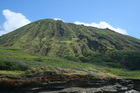
This is Koko Crater, a cinder cone that is approximately 10,000 years old, making it one of the youngest eruptive features on O'ahu. This crater is 1,207 feet in height and the slopes of it drop steeply into the Molokai Channel. Note how runoff has created numerous gullies and rills in the volcano's eastern slope.

Nearby is the fabulous Hanauma Bay, where a shoreline crater has been breached by the incoming waves. This has formed a protected cove that is quite popular with snorkelers. The last time I was here was in 1983 and the increase in visitation is staggering.

Wikipedia offered this aerial view of Koko Crater and Hanauma Bay and gives you a birds eye view of the scenic splendor of Oahu.

The afternoon waves batter the eastern coast of O'ahu

Around the corner to the north is a spectacular coastline with the famous North Shore pali (or sea cliff). Note the out-wash debris that protrudes out into the sea here. The northeast trade winds bring immense storm systems that slam into the islands, causing phenomenal runoff events that progressively (or catastrophically) create these features - a real estate brokers dream when it first happens but a home owners worst nightmare when it happens again.

Another view of the same pali further west along the North Shore drive. This pali formed when a huge chunk of O'ahu slid away to the north.

This map, used courtesy of the Monterey Bay Aquarium Research Institute, shows the two islands of O'ahu and Moloka'i (shaded in dark green). The other colors represent the depth of the seafloor, progressing from nearshore (white) to deep (dark blue). The light green and light blue areas depicted north of the islands are interpreted as large areas of debris that originated from catastrophic landslides from these two islands. The pali's originated when these landslides occurred. Note how the largest chuck of landslide material, located up to 70 miles away from O'ahu, lies parallel to the North Shore. Imagine these slides when they occurred and the tsunami's that likely resulted from them.

To learn more about this spectacular pali and how it formed, see the link here for the Monterey Bay Aquarium Research Institute.

Rabbit Island is another tuff cone along the North Shore that has been beaten by the sea on its eastern (right) side.

The Chinaman's Hat on O'ahu's North Shore. Read more about it here. It is composed of layers of lava that are erosional remnants from the main island flows (to the right off of the photo).

Another spectacular view of the pali as we wind our way west on the North Shore drive. Note how the runoff from all the rain here has created the pattern on the cliff wall.

Although Honolulu is what most people think of regarding O'ahu, we found this North Shore to be every bit as Hawaiian as any other place we've been in Hawai'i. It is rural, slow-paced, and very scenic.

The Waimea Valley looked very interesting to us, with a botanical garden and numerous trails. The entrance view from the highway was very enticing and we may return one day to check it out.

Next we saw a small crowd that had gathered and upon inspection found some green sea turtles hauled out on the beach.

As we watched, even more turtles came ashore. Volunteers stand nearby and move ropes that keep people from getting too close to the turtles.

The bridge entering Haleiwa on the North Shore.

Haleiwa is a delightful town where we strolled for about an hour.

In the graveyard of a Haleiwa church was this headstone - that of a missionary. It is always fun to walk around graveyards but this one made me wonder why some brow-beaten missionary thought Hawaiians needed to be "saved". How strange humans are sometimes.


On a lighter note were the many hippie shops located along the roadway. Seems other, later arrivals came here to be saved from the drudgery of mainland life.
This may look like a tourist shot of Helen and me on Waikiki Beach but it's actually a geology shot of Diamond Head in the background. (Note: We did enjoy Waikiki and always do when we are here. It is a great beach with a lot of history). Diamond Head is another tuff cone that was erupted about 150,000 years ago.

This is my sister Laura in front of the entrance to Diamond Head, where we hiked to the top.

The trail begins as a concrete sidewalk through the small forest on the crater floor...

but soon turns to an asphalt lane that swithbacks up the inside of the cone.

The view from the top is spectacular. You can see the floor of the crater where the hike begins. Note the tunnel one drives through to access the trailhead. The outer view is to the east and takes in the features shown at the start of this O'ahu roundabout - Koko Crater to the left and Koko Head to the right. The neighborhood of Port Lock where my sister lives sits below these two.

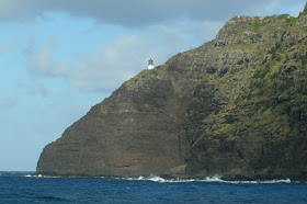
Here is a view of the lighthouse that faces the south on the Pacific Ocean.

And a final view of Honolulu to the west of Diamond Head. Note the gap in the high rise buildings along Waikiki Beach. You might see the pink Royal Hawaiian Hotel there where the picture of us on the beac h was taken. On the skyline is the Waianae volcano, the oldest of the two shield volcano's that made the island of O'ahu. It was active between about 3 and 4 million years ago.

Helen and I really enjoyed our time on O'ahu and there is much more to this island than shopping and surf.

Thursday, June 02, 2011

Hawaiian Geology at Haleakala Crater

I'm on vacation on the island of Maui in Hawai'i where Helen and I completed an eleven and a half mile hike on May 30 through Haleakala Crater. The summit of this impressive volcano rises 10,023 feet above sea level and after adding the 16,000 feet of height that is below sea level, this volcano is over 26,000 feet high! Take a look at some of the photos from the summit and inside the crater.

The view towards West Maui volcano. We set our alarm for 5 AM so that we could begin the hike well before the clouds build up. This is not how most visitors to Hawaii spend their day (alarm clocks, fleece jackets, hiking shoes and socks, etc.) but I can highly recommend this activity while visiting here. This view to the west is towards the West Maui volcano, already cloaked in clouds at 7 AM. The lowlands in the foreground is the valley between the two volcano's and is where most people reside on this island.

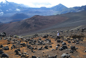
Our first view of the crater was from Kalahaku Overlook at 9324 feet along the summit road. The parking area reveals nothing but a short walk to the edge brings visitors to a most spectacular view. Haleakala is not an eruptive crater but rather is a depression that has formed from repeated slumping on the summit. In this wet tropical climate, moisture seeps into the volcanic rock, causing large portions of the mountain to slide down to the sea. This photo was taken on the west rim of the crater and looks across to the south rim, about two and half miles away. The obvious cinder cone on the floor of the crater is called Ka Lu'u o ka O'o.

Swinging the view farther to the left on the crater floor brings one to a cone called Kama oli'i. You can see that a lava flow issued from its right hand side, which flowed downhill to the east and around its near side. A typical sequence in many cinder cone eruptions is that gas charged lava erupts first in fountains of lava droplets. These cool and form the cinder cone around the vent. Once the gas is gone out of the lava, it cannot be thrown up into a fountain and pools within the cone. It then breaches the side of the cone as a lava flow.


Swinging our view even further left brings this scene. The lava flow that erupted from Kama oli'i has almost completely engulfed a previously formed cone (seen embedded in the middle of the lava flow). Another cone is present beyond the flow and it is called Pu'u o Maui. Maui is the demi-god namesake of the island.

A last look from Kalahaku Overlook with the highest mountain on Earth visible in the far distance, Mauna Loa on the Big Island of Hawai'i. It is over 13,000 feet above sea level and is higher than Mt. Everest with it's submarine portion included in its height. The air quality was outstanding this day to achieve this view.

On the summit of Haleakela are a number of astronomical observatories and NASA  space tracking facilities. They are off-limits to the public but easily visible from  the summit which has a small hut for viewing out of the wind or snow (when they have snow).

Helen beginning the hike at about 8:30 in the morning. In the entire 11.5 miles, we saw perhaps six people on the trail.

This is a view to the west as the trail switchbacks down the side of the crater.

A view to the north back towards the direction of Kalahaku Overlook. The spectacular wall in the distance is the cliff we would ascend to exit the crater about five and half hours later.

The silversword (Argyroxiphium sp.) is an endemic plant on Haleakala that takes 5 to 50 years to bloom, signaling the end of its life cycle.

Silversword close-up. I took a side hike on the Silversword Loop where hundreds of these were growing in their native habitat of rocky, well-drained soil.

Looking back to the west towards the summit of Haleakala (located on the flat-looking ridge top left). The chain of craters was formed along a rift present beneath the volcano.

The floor of the crater has some green growth on it, especially where the windward side rains spill into it. Here you can see some clouds moving into the crater from the windward side.

Here is a a view of Pu'u o Maui from the floor of Haleakala Crater. Compare this view with the one from the overlook above.

I accidentally hit a button on my camera and then about 60 of my pictures were taken in black and white. Here Helen approaches our lunch spot near a spatter cone or hornito. The lava globules in the walls of this were fantastically preserved.

Just before our ascent we looked back up at the wall we had to climb. Good thing I took the photo at this moment as the clouds began to roll in off of the Pacific.

In Hawai'i, volcanic features are so easily seen and observed. Here along the trail in the floor of Haleakala is a lava tube partially obscured by a patch of grass and flowers (upper left). A  pahoehoe flow issues from this with lava levees on either side of it. This is textbook volcanology!

After finishing the hike we looked out into the Pacific Ocean and saw the area near Big beach with ts shoreline cinder cone. The little islet in the sea is called Mokulini and is a crater that is breached on one side with the ocean inside it. Te island of Kaho' o lowe is in the distance.